Posted 2nd June 2016 | 1 Comment
Network Rail takes to the sky
NETWORK RAIL has recruited a drone – officially dubbed an Unmanned Aerial Vehicle – to see the lie of the land along the south Devon coast, which was the scene of so much disruption when savage winter weather destroyed parts of the sea wall at Dawlish and the railway it carries in early 2014.
Network Rail is now conducting a wider study into the effects of coastal flooding, erosion and cliff instability on this part of the Great Western route and the options available to limit the effects of these in the future.
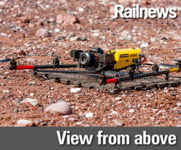
As a result the drone has been scanning the area, capturing images which will help engineers plan the next steps, and which would have been less easy to obtain using a manned helicopter. It was launched from the sea and quickly recorded a lot of useful footage.
The team has also started taking soil and rock samples to establish the make-up of the cliffs. This will allow Network Rail to draw up detailed engineering designs tailored to each cliff area.
Joanna Grew, Network Rail’s commercial scheme sponsor for the project, said: “Over the next few weeks residents are likely to see a lot of activity in the Dawlish and Teignmouth areas as we progress our plans to secure the future of this historic and important part of the Great Western route.
Securing the future of this line is extremely important to us, which is why we are using the latest technology to build up the most accurate picture of the landscape, how it is likely to change, and what we can do to improve its resilience.”
Network Rail’s study outlining the options available to improve the resilience of this section of the Great Western route was being submitted to the Department for Transport for consideration at the end of May.
Reader Comments:
Views expressed in submitted comments are that of the author, and not necessarily shared by Railnews.
Chris Green, Huddersfield
Good, improvements to the network could be generated through looking down from the sky. Not all inspecting has to be on ground level.